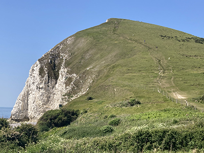
I’ll be the first to put my hand up and admit my mistake. It was naïve of me to only consider the route in terms of distance when I was planning to walk the South West Coast Path and not elevation.
On paper, the 7½ miles between Lulworth Cove and Kimmeridge sounded like a morning stroll; similarly, the 13½ miles from Kimmeridge to Swanage nothing more than a healthy schlep. The trouble was my paper was flat, where the landscape distinctly was not. It was up and down. Proper up and down.
Add to that, I was walking during a May heatwave. In fact, the hottest UK May temperatures on record. Somewhere, the mercury hit 35.1°C.
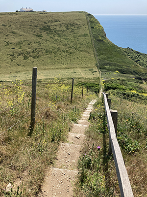
During the walk, I experienced two genuine moments of “am I being stupid doing this?”; one long, grinding walk of attrition; and one moment of mild hysteria. They occurred, respectively, at the foot of both Bindon Hill and Houns Tout Cliffs; walking up Tyneham Cap; and faced with the ‘downie upsie’ at St Adhelm’s Head. Why couldn’t someone have just built a bridge across that gap?
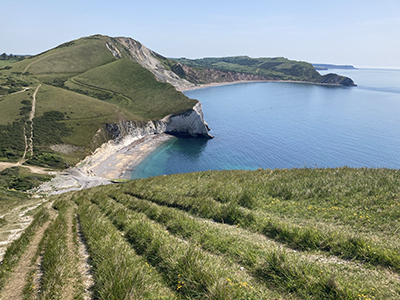
But, in each case, the physical misery of the ascent (sometimes descent) was outweighed by the beauty of the natural scenery; the difficulty of the climb by the sense of achievement when the summit was finally won.
When I was at school, I was taught to read the contour profile of a map, but it is a lesson that I have clearly forgotten during the intervening years.
Thankfully, the final section of my coastal walk, from Swanage to Poole was relatively flat. The only elevations I had to face there were on the one-mile section of nudist beach between Studland and Shell Bay. And they weren’t anything to talk about.
© E. C. Glendenny

E. C. Glendenny prefers going down to going up. Oo-er, matron.
